Description
Rugged, Full-featured Handheld with GPS, GLONASS and Wireless Connectivity2.6" sunlight-readable color screenHigh-sensitivity GPS and GLONASS receiver with quad helix antennaPreloaded TOPO U.S. 100K maps plus a 1-year BirdsEye Satellite Imagery subscription3-axis compass with barometric altimeterWireless connectivity via Bluetooth technology or ANT+GPSMAP 64st features a 2.6" sunlight-readable color screen and a high-sensitivity GPS and GLONASS receiver with a quad helix antenna for superior reception. GPSMAP 64st includes a 3-axis electronic compass with barometric altimeter, wireless connectivity, and preloaded TOPO U.S. 100K maps plus a 1-year BirdsEye Satellite Imagery subscription.Explore the Terrain - GPSMAP 64st comes with a worldwide basemap with shaded relief and is preloaded with TOPO 100K, which includes coverage of the full U.S., including Alaska, Hawaii and Puerto Rico. Plus it includes a 1-year BirdsEye Satellite Imagery subscription - all the tools for serious climbing or hiking. Map detail includes national, state and local parks and forests, along with terrain contours, elevation information, trails, rivers, lakes and points of interest.Get Your Bearings - GPSMAP 64st has a built-in 3-axis tilt-compensated electronic compass, which shows your heading even when you're standing still, without holding it level. Its barometric altimeter tracks changes in pressure to pinpoint your precise altitude, and you can even use it to plot barometric pressure over...
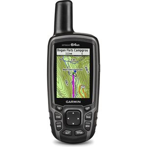
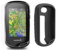
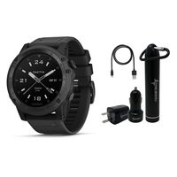
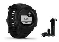
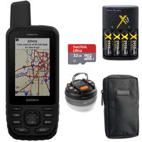
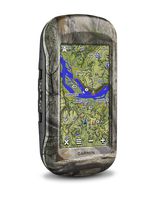
Garmin GPSMAP 64st Worldwide Handheld GPS with 1 Yr. Birdseye Subscription and Preloaded TOPO U.S. 100K Maps + 1-Year Extended Warranty Bundle
Price is below average
Current Price
$249
Average
$261
Min Price
$229.95
Max Price
$329.99
Price dynamics
5%
Description
Rugged, Full-featured Handheld with GPS, GLONASS and Wireless Connectivity2.6" sunlight-readable color screenHigh-sensitivity GPS and GLONASS receiver with quad helix antennaPreloaded TOPO U.S. 100K maps plus a 1-year BirdsEye Satellite Imagery subscription3-axis compass with barometric altimeterWireless connectivity via Bluetooth technology or ANT+GPSMAP 64st features a 2.6" sunlight-readable color screen and a high-sensitivity GPS and GLONASS receiver with a quad helix antenna for superior reception. GPSMAP 64st includes a 3-axis electronic compass with barometric altimeter, wireless connectivity, and preloaded TOPO U.S. 100K maps plus a 1-year BirdsEye Satellite Imagery subscription.Explore the Terrain - GPSMAP 64st comes with a worldwide basemap with shaded relief and is preloaded with TOPO 100K, which includes coverage of the full U.S., including Alaska, Hawaii and Puerto Rico. Plus it includes a 1-year BirdsEye Satellite Imagery subscription - all the tools for serious climbing or hiking. Map detail includes national, state and local parks and forests, along with terrain contours, elevation information, trails, rivers, lakes and points of interest.Get Your Bearings - GPSMAP 64st has a built-in 3-axis tilt-compensated electronic compass, which shows your heading even when you're standing still, without holding it level. Its barometric altimeter tracks changes in pressure to pinpoint your precise altitude, and you can even use it to plot barometric pressure over...
Price will be lower
in next 2 weeks
in next 2 weeks
According to the data, price will be lower in next two weeks, so not waste your money and track better price!
Product review & video
in this video we're going to take a look at using Garmin birds eye's satellite imagery with the GPS map 64 series of handheld outdoor units these units come with one free year of birds eye's satellite imagery to download bird's eye you will need to connect your GPS to your computer register it through Garmin Express and then make sure that you are using the latest version of garmin basecamp now in Basecamp I can zoom in on the region that I'm interested in and with my 64 still connected to my computer from the menu up top I can select bird's-eye and then download bird's-eye imagery once Basecamp has recognized my GPS I can select continue from the pop-up box from here we can select what area we want to download and add to our GPS when you select a region you can choose between selecting it as a box or you can do it as a different shape next you can choose what quality of image that you


Similar products
