Description
For low-altitude instrument pilots, the FAA's Enroute Low Altitude Charts are the official, go-to source for all the critical info you need to safely operate in the IFR environment. Designed for navigational use up to (but not including) 18,000 feet, these 4-color charts depict such need-to-know info as Victor Airways, navigational fixes, ATC reporting points, military training routes (MTRs), RNAV routes, special use airspace, controlled airspace boundaries, VHF navigational facilities (frequency, ID, geographic coordinates, and channel), and much more safety-of-flight data.Ideal for extended East-West IFR ops, the L-9 & L-10 chart covers much of the West and Midwest stretching from CA all the way to MO and IA. Also covers portions of NV, UT, CO, KS, and NE. Low-altitude chart scales vary from 5 to 20 nm per inch. Published on the FAA's standard 56-day cycle. Available both as a one-time purchase or as a subscription, this is an affordable, value-packed resource that should be a "no-go" item for all IFR flights in the Midwest/Western US.
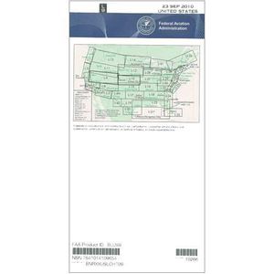
L-9 & L-10 Low Alt (June 30, 2011 through August 25, 2011)
Current Price
$12.49
Average
$5.8
Min Price
$2.89
Max Price
$12.49
Price dynamics
54%
Description
For low-altitude instrument pilots, the FAA's Enroute Low Altitude Charts are the official, go-to source for all the critical info you need to safely operate in the IFR environment. Designed for navigational use up to (but not including) 18,000 feet, these 4-color charts depict such need-to-know info as Victor Airways, navigational fixes, ATC reporting points, military training routes (MTRs), RNAV routes, special use airspace, controlled airspace boundaries, VHF navigational facilities (frequency, ID, geographic coordinates, and channel), and much more safety-of-flight data.Ideal for extended East-West IFR ops, the L-9 & L-10 chart covers much of the West and Midwest stretching from CA all the way to MO and IA. Also covers portions of NV, UT, CO, KS, and NE. Low-altitude chart scales vary from 5 to 20 nm per inch. Published on the FAA's standard 56-day cycle. Available both as a one-time purchase or as a subscription, this is an affordable, value-packed resource that should be a "no-go" item for all IFR flights in the Midwest/Western US.
Price will be lower
in next 2 weeks
in next 2 weeks
According to the data, price will be lower in next two weeks, so not waste your money and track better price!
Similar products
