Description
With the TOPO! map of Colorado, National Geographic has taken the interactive topographic map experience to a new level. By combining its own standard-setting maps with the high-quality scanned versions of the actual paper USGS topographical maps, the National Geographic TOPO! State Series offers five levels of map detail that is unprecedented in its accuracy. Professional and weekend hikers alike will be amazed at how indispensable TOPO! will quickly become in the back country.
Simply load TOPO! onto your Mac, and you'll immediately begin to see the benefits of this award-winning software. With TOPO! you can customize any of the hundreds of state maps available with your proposed routes, notes and even photos. You can also create and view elevation profiles that will help you visualize your planned trek. By connecting to any standard color or black-and-white desktop printer, TOPO! allows you to select the exact area that you want to print, even if it is larger than the screen or covers multiple quad maps. TOPO! makes it a breeze to add map border information to printouts, including UTM or latitude/longitude grids, scale bars, north arrows, and magnetic declination. With Adventure Paper (sold separately) you can print out waterproof trail maps -- along with all your marks and annotations -- that will survive any rainstorm the wilderness can throw at you.
TOPO! is also GPS ready, with no extensions or upgrades required. Transferring waypoints and routes between your GPS and TOPO! couldn't be easier. No more worries about not being able to read your notes or misplacing your notebooks. Everything you need for your next hike will be saved exactly where it should be--with your map!
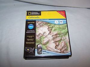
National Geographic TOPO! Colorado Map CD-ROM (Mac)
Price is below average
Current Price
$27
Average
$76.4
Min Price
$24.98
Max Price
$198
Price dynamics
65%
Description
With the TOPO! map of Colorado, National Geographic has taken the interactive topographic map experience to a new level. By combining its own standard-setting maps with the high-quality scanned versions of the actual paper USGS topographical maps, the National Geographic TOPO! State Series offers five levels of map detail that is unprecedented in its accuracy. Professional and weekend hikers alike will be amazed at how indispensable TOPO! will quickly become in the back country.
Simply load TOPO! onto your Mac, and you'll immediately begin to see the benefits of this award-winning software. With TOPO! you can customize any of the hundreds of state maps available with your proposed routes, notes and even photos. You can also create and view elevation profiles that will help you visualize your planned trek. By connecting to any standard color or black-and-white desktop printer, TOPO! allows you to select the exact area that you want to print, even if it is larger than the screen or covers multiple quad maps. TOPO! makes it a breeze to add map border information to printouts, including UTM or latitude/longitude grids, scale bars, north arrows, and magnetic declination. With Adventure Paper (sold separately) you can print out waterproof trail maps -- along with all your marks and annotations -- that will survive any rainstorm the wilderness can throw at you.
TOPO! is also GPS ready, with no extensions or upgrades required. Transferring waypoints and routes between your GPS and TOPO! couldn't be easier. No more worries about not being able to read your notes or misplacing your notebooks. Everything you need for your next hike will be saved exactly where it should be--with your map!
Price will be lower
in next 2 weeks
in next 2 weeks
According to the data, price will be lower in next two weeks, so not waste your money and track better price!
