Description
Waterproof, tear-resistant topographic hiking map covering all of the hiking trails in the Mount Zirkel Wilderness in the Park Range along the continental divide in northern Colorado, including a large area of the Routt National Forest north of Steamboat Springs. The front side of the map covers the southern half of the wilderness, from Buffalo Pass north Seedhouse Rd. The back of the map shows the northern portions of the wilderness, including the Continental Divide Trail. The motorized Grizzly-Helena trail along the eastern border is also covered.
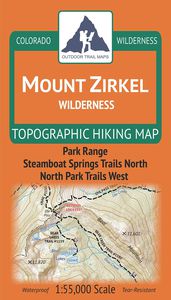
Outdoor Trail Maps Mount Zirkel Wilderness - Colorado Topographic Hiking Map (2019)
Current Price
$8.95
Average
$8.95
Min Price
$8.95
Max Price
$8.95
Description
Waterproof, tear-resistant topographic hiking map covering all of the hiking trails in the Mount Zirkel Wilderness in the Park Range along the continental divide in northern Colorado, including a large area of the Routt National Forest north of Steamboat Springs. The front side of the map covers the southern half of the wilderness, from Buffalo Pass north Seedhouse Rd. The back of the map shows the northern portions of the wilderness, including the Continental Divide Trail. The motorized Grizzly-Helena trail along the eastern border is also covered.
Price will be lower
in next 2 weeks
in next 2 weeks
According to the data, price will be lower in next two weeks, so not waste your money and track better price!
