Description
BlueChart® g2 HD - HXSA002R - South America West Coast - microSD™/SD™Coverage of the west coast of Central and South America from Acalpulco, Mexico to Tierra del Fuego and then north to Puerto Deseado, Argentina. Coverage also includes the east coast of Panama; the Panama Canal; the Galapagos Islands; Lake Titicaca; the Falkland Islands (Islas Malvinas); San Felix Island and the San Fernandez Islands including Selkirk.Our Advanced Chart OfferingDerived from official charts and private sources to provide navigational aids, spot soundings, depth contours, tides and currents, and detailed harbors and marinasDepth Range Shading for up to 10 depth ranges enables you to view your target depth at a glanceUp to 1-foot contours provide a more accurate depiction of the bottom structure for improved fishing charts and navigation in swamps, canals and marinasShallow Water Shading feature allows for depth shading at a user-defined level to aid in navigationAdvanced Chart DetailDetailed charts help the mariner guide their boat in and out of port with confidence.Depth Range ShadingDisplays high-resolution Depth Range Shading for up to 10 depth ranges so you can view your designated target depth.Detailed ContoursBlueChart g2 HD features 1-foot contours that provide a more accurate depiction of bottom structure for improved fishing charts and enhanced detail in swamps, canals and port plans. WARNING: This product can expose you to chemicals which are known to the State of California to cause cancer, birth defects or other reproductive harm. For more information go to P65Warnings.ca.gov.
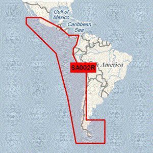
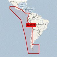
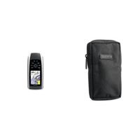
Garmin BlueChart g2 - HXSA002R - South America West Coast - microSDTM/SDTM (41208)
Current Price
$145.21
Average
$140.94
Min Price
$127.08
Max Price
$266.81
Price dynamics
3%
Description
BlueChart® g2 HD - HXSA002R - South America West Coast - microSD™/SD™Coverage of the west coast of Central and South America from Acalpulco, Mexico to Tierra del Fuego and then north to Puerto Deseado, Argentina. Coverage also includes the east coast of Panama; the Panama Canal; the Galapagos Islands; Lake Titicaca; the Falkland Islands (Islas Malvinas); San Felix Island and the San Fernandez Islands including Selkirk.Our Advanced Chart OfferingDerived from official charts and private sources to provide navigational aids, spot soundings, depth contours, tides and currents, and detailed harbors and marinasDepth Range Shading for up to 10 depth ranges enables you to view your target depth at a glanceUp to 1-foot contours provide a more accurate depiction of the bottom structure for improved fishing charts and navigation in swamps, canals and marinasShallow Water Shading feature allows for depth shading at a user-defined level to aid in navigationAdvanced Chart DetailDetailed charts help the mariner guide their boat in and out of port with confidence.Depth Range ShadingDisplays high-resolution Depth Range Shading for up to 10 depth ranges so you can view your designated target depth.Detailed ContoursBlueChart g2 HD features 1-foot contours that provide a more accurate depiction of bottom structure for improved fishing charts and enhanced detail in swamps, canals and port plans. WARNING: This product can expose you to chemicals which are known to the State of California to cause cancer, birth defects or other reproductive harm. For more information go to P65Warnings.ca.gov.
Price will be lower
in next 2 weeks
in next 2 weeks
According to the data, price will be lower in next two weeks, so not waste your money and track better price!
Similar products